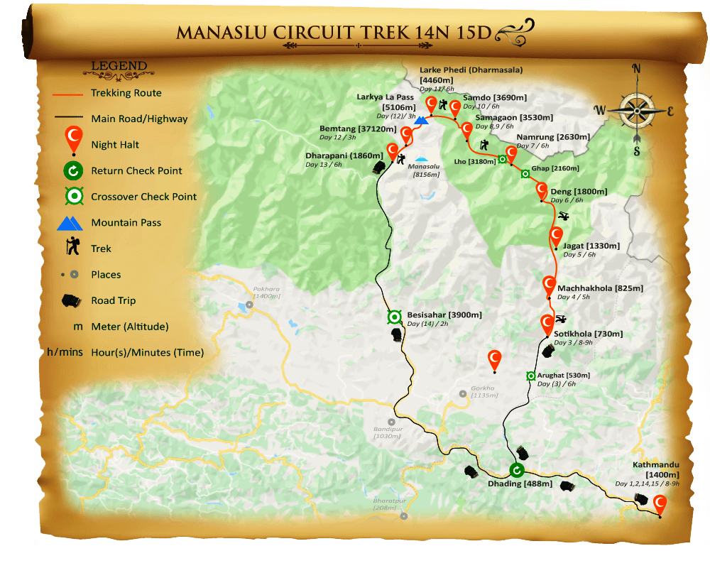
This Manaslu Circuit Trek Map 14N 15D or Manaslu Valley Trek Map 14N 15D is for the trekkers just to have a map glimpse of the Manaslu trekking route in Manaslu Conservation Area, checkpoints, days and time, places to spend the nights during the trekking period, starting and ending places, etc. according to the itinerary. This map is not for the actual scaling or for the trekking purpose. This map is designed to assist as a reference for the trekking program and to get the general idea of the trekking.
Outline Itinerary
Day 01: Kathmandu (1400m) Arrival
Day 02: Kathmandu Heritage Sightseeing.
Day 03: Kathmandu to Sotikhola (730m): Drive 8-9 hours.
Day 04: Sotikhola to Machha Khola (900m): Trek 5 hours.
Day 05: Machhakhola to Jagat (1410m): Trek 6 hours
Day 06: Jagat to Deng (1804m): Trek 6 hours.
Day 07: Deng to Namrung (2630m): Trek 7 hours.
Day 08: Namrung to Samagaon (3530m): Trek 6-7 hours.
Day 09: Acclimatization Day (3530m) and Explore Pung Gyen Monastery: 6-7 hours.
Day 10: Samagaon to Samdo (3860m): Trek 4 - 5 hours.
Day 11: Samdo to Dharmasala/Larkya Phedi/ Larkya Base Camp (4460m): Trek 4 - 5 hours.
Day 12: Dharmasala to Larkya La Pass (5106m) to Bemtang (3720m): Trek 8 - 9 hours.
Day 13: Bemtang to Tilche/Tilije (2300m) to Dharapani (1860m): Trek 6-7 hours.
Day 14: Dharapani to Besisahar to Kathmandu (1400m): Drive 8-9 hours.
Day 15: Return Departure.